
Analysis of Morphometric Parameters and Prioritization for Flood Vulnerability of River Sub-Basins in Hong LGA Adamawa State, Northeastern Nigeria
DOI:
https://doi.org/10.33003/fjs-2026-1014-5788Keywords:
Morphomeric, Prioritization, VulerabilityAbstract
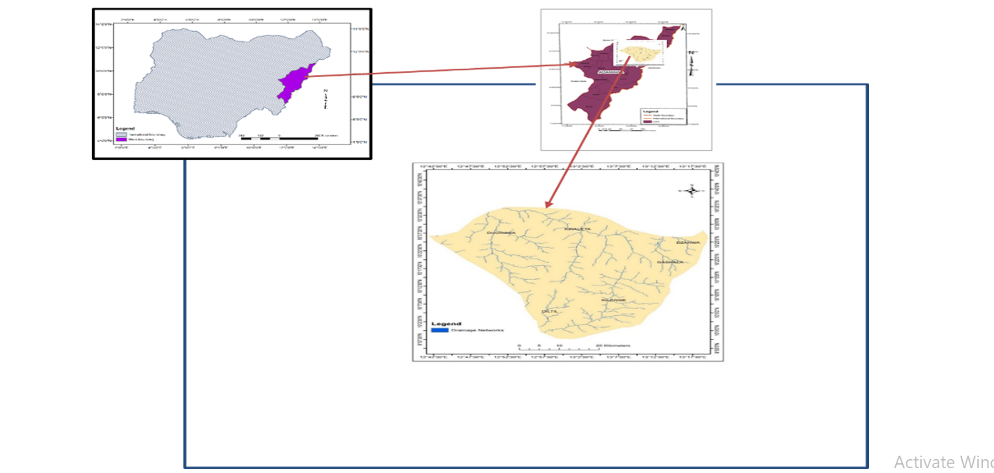
Flooding is one of the most destructive natural hazards globally, with its frequency and severity amplified by climate change, land use alterations, and geomorphic characteristics of watersheds. This study assessed flood vulnerability in Hong Local Government Area (LGA), Adamawa State, Nigeria, through morphometric and relief analysis supported by Geographic Information System (GIS) techniques. The objectives were to delineate major basins in the study area, compute morphometric parameters, and prioritize them based on susceptibility to flooding. Six watersheds—Kwaleta, Kilange, Dugwaba, Diltil, Gashala, and Dzakwa—were delineated from Shuttle Radar Topography Mission (SRTM) Digital Elevation Model. Linear, areal, and relief parameters were calculated using standard morphometric formulae, and prioritization was conducted through composite rating (CR) values. Findings reveal significant variation across basins. Drainage density, stream frequency, infiltration number, and ruggedness number showed higher flood susceptibility in Kilange, Gashala and Dugwaba, while Kwaleta, Diltil and Dzakwa exhibited moderate to low vulnerability. These results are significant because the study area is ungauged, and morphometric analysis provides critical baseline data for flood management, land use planning, and runoff harvesting. It is recommended that local authorities integrate these findings into watershed management strategies, strengthen flood early-warning systems, and promote afforestation and soil conservation measures to reduce runoff and enhance resilience.
References
Abuzied, S. M., Yuan, M., Ibrahim, S. S., Kaiser, M. F., & Saleem, T. A. (2016). GIS-based morphometric analysis of Wadi Qena watershed, Eastern Desert, Egypt. Journal of African Earth Sciences, 124, 292–308. https://doi.org/10.1016/j.jafrearsci.2016.09.025
Adebayo, A. A., & Dayya, D. (2004). Fundamentals of development studies. Yola: Paraclete Publishers.
Adebayo, A. A., & Tukur, A. L. (1999). Adamawa State in maps. Yola: Paraclete Publishers.
Adnan, M. S. G., Dewan, A., Zannat, K. E., & Abdallah, A. F. B. (2019). The use of morphometric analysis for flood hazard assessment of the Surma River basin in Bangladesh. Environmental Earth Sciences, 78(1), 1–17. https://doi.org/10.1007/s12665-018-8026-9
Aher, P. D., Adinarayana, J., & Gorantiwar, S. D. (2014). Prioritization of watersheds using multi-criteria evaluation through fuzzy analytical hierarchy process. Environmental Earth Sciences, 71(1), 507–521. https://doi.org/10.1007/s12665-013-2444-4
Akintoye, O. A., Akinluyi, F. O., Komolafe, A. A., & Adeaga, O. (2016). Flood risk analysis of coastal communities of Lagos, Nigeria. Natural Hazards, 84(1), 715–735. https://doi.org/10.1007/s11069-016-2436-5
Alam, A., Bhat, M. S., Maheen, M., & Ahmed, P. (2021). Morphometric analysis of Vishav drainage basin using geospatial techniques. Applied Water Science, 11(1), 1–15. https://doi.org/10.1007/s13201-020-01339-0
Alam, M. A., Ahmed, B., & Sammonds, P. (2020). Flash flood susceptibility assessment of Cox’s Bazar District of Bangladesh using geospatial techniques. Natural Hazards, 100, 883–908. https://doi.org/10.1007/s11069-019-03840-y
Altaf, F., Meraj, G., & Romshoo, S. A. (2013). Morphometric analysis to infer hydrological behaviour of Lidder watershed, Western Himalaya, India. Geography Journal, 2013, 1–14. https://doi.org/10.1155/2013/178248
Altaf, F., Meraj, G., & Romshoo, S. A. (2014). Morphometric analysis to infer hydrological behaviour of Lidder watershed, Western Himalaya, India. Geography Journal, 2014, 1–14. https://doi.org/10.1155/2014/178248
Amoateng, P., Cobbinah, P. B., & Owusu-Adade, K. (2018). Managing flood risk in African cities: An integrated approach. Cities, 81, 95–102. https://doi.org/10.1016/j.cities.2018.03.009
Arnous, M. O., Aboulela, H. A., & Green, D. R. (2011). Geo-environmental hazards assessment of the northwestern Gulf of Suez, Egypt, using remote sensing and GIS techniques. Environmental Earth Sciences, 63(2), 329–347. https://doi.org/10.1007/s12665-010-0700-7
Bhat, S., Bhat, M. S., & Rashid, I. (2019). Morphometric analysis using remote sensing and GIS techniques in the Sindh Basin, Kashmir Valley, India. Applied Water Science, 9(1), 1–15. https://doi.org/10.1007/s13201-018-0889-9
Bhatt, S., & Ahmed, S. (2014). Morphometric analysis to determine floods in the Upper Krishna Basin using Cartosat DEM. Geocarto International, 29(8), 878–894. https://doi.org/10.1080/10106049.2013.868043
Bhatt, S., Kumar, R., & Singh, A. (2014). Morphometric analysis of Suketi river basin (Himachal Pradesh) using geographical information system. International Journal of Advanced Remote Sensing and GIS, 3(1), 707–715.
Biswas, S., Sudhakar, S., & Desai, V. R. (1999). Prioritisation of subwatersheds based on morphometric analysis of drainage basin: A remote sensing and GIS approach. Journal of the Indian Society of Remote Sensing, 27(3), 155–166. https://doi.org/10.1007/BF02991569
Borga, M., Gaume, E., Creutin, J. D., & Marchi, L. (2008). Surveying flash floods: gauging the ungauged extremes. Hydrological Processes, 22(18), 3883–3885. https://doi.org/10.1002/hyp.7111
Brunner, M. I., Seibert, J., & Favre, A. C. (2018). Bivariate return periods and their importance for flood peak and volume estimation. Wiley Interdisciplinary Reviews: Water, 5(1), e1253. https://doi.org/10.1002/wat2.1253
Charizopoulos, N., Psilovikos, A., Psilovikos, T., & Karymbalis, E. (2019). Morphometric analysis of drainage networks as a tool for water resources management: A case study in Greece. Water, 11(9), 1835. https://doi.org/10.3390/w11091835
Charlton, R. (2008). Fundamentals of fluvial geomorphology. Routledge. https://doi.org/10.4324/9780203945981
Chatterjee, S., Krishna, A. P., & Sharma, A. P. (2013). Geospatial assessment of soil erosion vulnerability using the MCDM-AHP technique. Environmental Earth Sciences, 68(7), 1979–1992. https://doi.org/10.1007/s12665-012-1875-0
Chorley, R. J., Malm, D. E. G., & Pogorzelski, H. A. (1957). A new standard for estimating drainage basin shape. American Journal of Science, 255(2), 138–141. https://doi.org/10.2475/ajs.255.2.138
Daniel, E. I., & Udo, I. A. (2019). Environmental impacts of flood disasters in Nigeria: A review. International Journal of Environment and Pollution Research, 7(2), 19–33.
Das, S. (2020). Morphometric analysis of the Kangsabati River basin using remote sensing and GIS techniques in West Bengal, India. Applied Water Science, 10(7), 1–12. https://doi.org/10.1007/s13201-020-01241-6
Dube, T., Gumindoga, W., & Chawira, M. (2014). Detection of land cover changes and land surface temperature in the mining district of Hwange, Zimbabwe. Egyptian Journal of Remote Sensing and Space Sciences, 17(2), 263–274. https://doi.org/10.1016/j.ejrs.2014.05.003
El-Shater, A. H., Youssef, A. M., Pradhan, B., & Fanos, A. M. (2021). Flood hazard assessment for Egypt’s Nile Delta using geospatial techniques. Geosciences, 11(1), 16. https://doi.org/10.3390/geosciences11010016
Farhan, Y., Anaba, O., & Salim, S. (2016). Morphometric analysis and flash flood assessment for drainage basins of the Ras En Naqb area, South Jordan using GIS. Journal of Geoscience and Environment Protection, 4(10), 9–33. https://doi.org/10.4236/gep.2016.410002
FEMA. (2016). Flood hazard mapping. Federal Emergency Management Agency. https://www.fema.gov
Frimawaty, E., Anwar, S., Rahman, H., & Syamsidik. (2023). Climate change and flood disasters in Indonesia: Challenges and opportunities for adaptation. Water, 15(3), 521. https://doi.org/10.3390/w15030521
Gaborit, É. (2022). Coastal flooding and climate change: Vulnerability of urban waterfronts. Journal of Coastal Research, 38(5), 1039–1048. https://doi.org/10.2112/JCOASTRES-D-21-00036.1
Garkida, Nigeria. (n.d.). Topographic map, Sheet 155. Federal Surveys of Nigeria.
Ghany, H. A. (2015). Morphometric analysis and flood hazard assessment for Wadi Sudr and Wadi Wardan, Gulf of Suez, Egypt. Journal of Earth Sciences and Geotechnical Engineering, 5(4), 1–19.
Ghany, H. A. (2015). Morphometric analysis and prioritization of Wadi Feiran basin, southern Sinai, Egypt, using GIS techniques. Arabian Journal of Geosciences, 8(4), 2079–2092. https://doi.org/10.1007/s12517-013-1192-2
Ghosh, S., Sharma, D., & Mishra, V. (2023). Global flood risk under climate change: A review. Current Climate Change Reports, 9(1), 41–56. https://doi.org/10.1007/s40641-023-00198-y
Gizachew, A., & Berhan, G. (2018). Watershed morphometric analysis and its implication for hydrological response in the upper Blue Nile Basin, Ethiopia. Hydrology: Current Research, 9(2), 1–9. https://doi.org/10.4172/2157-7587.1000290
Gravelius, H. (1914). Flusskunde. Goschen, Berlin: Verlag von Goschen.
Handayani, W., Widyastuti, M., & Marfai, M. A. (2020). Community response to flood risk management in Semarang, Indonesia. International Journal of Disaster Risk Reduction, 50, 101707. https://doi.org/10.1016/j.ijdrr.2020.101707
Horton, R. E. (1932). Drainage basin characteristics. Transactions, American Geophysical Union, 13, 350–361. https://doi.org/10.1029/TR013i001p00350
Horton, R. E. (1945). Erosional development of streams and their drainage basins: Hydrophysical approach to quantitative morphology. Geological Society of America Bulletin, 56(3), 275–370. https://doi.org/10.1130/0016-7606(1945)56[275:EDOSAT]2.0.CO;2
Iyiade, A. A. (2008). Climate, geomorphology and soils. In A. A. Adebayo (Ed.), Mubi region: A geographical synthesis (pp. 21–30). Yola: Paraclete Publishers.
Javed, A., Khanday, M. Y., & Ahmed, R. (2009). Prioritization of sub-watersheds based on morphometric and land use analysis using remote sensing and GIS techniques. Journal of the Indian Society of Remote Sensing, 37(2), 261–274. https://doi.org/10.1007/s12524-009-0016-8
Kaur, R., Singh, S., Verma, R., & Pateriya, B. (2014). Morphometric analysis of watershed using GIS: A case study. International Journal of Remote Sensing Applications, 4(3), 80–89.
Kousky, C. (2016). Impacts of natural disasters on children. Future of Children, 26(1), 73–92. https://doi.org/10.1353/foc.2016.0004
Kumar, R., Kumar, D., Lohani, A. K., Nema, R. K., & Singh, R. D. (2000). Evaluation of geomorphological characteristics of a catchment using GIS. GIS India, 9(3), 13–17.
Maddox, R. A. (2014). Flash floods: Forecasting and warning. In J. F. Shroder (Ed.), Natural hazards and disasters (pp. 189–214). Academic Press.
Magilligan, F. J., Buraas, E. M., & Renshaw, C. E. (2015). The geomorphic function of floods: A century of river floods in the United States. Earth Surface Processes and Landforms, 40(8), 1131–1146. https://doi.org/10.1002/esp.3690
Melton, M. A. (1957). An analysis of the relations among elements of climate, surface properties, and geomorphology. Columbia University Press.
Mhd Noor, M., Othman, N., & Rahman, N. H. A. (2022). Flood vulnerability and resilience assessment: Case of Malaysia. International Journal of Disaster Risk Reduction, 68, 102728. https://doi.org/10.1016/j.ijdrr.2021.102728
Miller, V. C. (1953). A quantitative geomorphic study of drainage basin characteristics in the Clinch Mountain area, Virginia and Tennessee. Technical Report 3, Columbia University, Department of Geology.
Mycoo, M., Wairiu, M., Campbell, D., Duvat, V. K., Golbuu, Y., Maharaj, S. & Warrick, O. (2022). Small islands. In H.-O. Pörtner et al. (Eds.), Climate change 2022: Impacts, adaptation and vulnerability. Contribution of Working Group II to the IPCC Sixth Assessment Report (pp. 2043–2120). Cambridge University Press.
Okumura, L. L., & Araujo, J. C. (2014). Use of high-resolution DEM for watershed characterization and hydrological modeling. Journal of Hydrologic Engineering, 19(2), 387–400. https://doi.org/10.1061/(ASCE)HE.1943-5584.0000810
Pariartha, I. G. A., Dewi, A. A. I. A., & Sudarma, I. M. (2023). Meteorological and land cover factors of flood disasters in Bali, Indonesia. Natural Hazards, 117(1), 559–578. https://doi.org/10.1007/s11069-023-05813-2
Patel, D. P., Dholakia, M. B., Naresh, N., & Srivastava, P. K. (2012). Water harvesting structure site selection using geospatial techniques: A case study of Dhasan River Basin, India. Journal of Earth System Science, 121(4), 1091–1104. https://doi.org/10.1007/s12040-012-0208-6
Patel, D. P., Dholakia, M. B., Naresh, N., & Srivastava, P. K. (2013). Infiltration number as a measure for prioritization of watersheds for soil and water conservation. Hydrological Processes, 27(26), 3885–3897. https://doi.org/10.1002/hyp.9513
Pirnia, A., Darabi, H., & Karimi, S. (2019). The impact of land use changes on flood hazard in urban watersheds. Water and Environment Journal, 33(4), 615–628. https://doi.org/10.1111/wej.12404
Puno, G. R., & Puno, R. C. C. (2019). Morphometric analysis for watershed characterization in the Philippines. Applied Geomatics, 11(2), 187–199. https://doi.org/10.1007/s12518-018-00239-5
Puno, G. R., Medina, C. D., & Puno, R. C. C. (2022). Flood hazard mapping and climate change vulnerability assessment of Misamis Oriental, Philippines. Water, 14(19), 3064. https://doi.org/10.3390/w14193064
Ramadhan, F., Abdurrahman, M., & Kurniawan, H. (2023). Anthropogenic factors in flood disasters: A case study from Indonesia. Sustainability, 15(6), 5213. https://doi.org/10.3390/su15065213
Ratnam, K. N., Rao, V. V., & Amminedu, E. (2005). Check-dam positioning by prioritization of micro-watersheds using SYI model and GIS. Journal of the Indian Society of Remote Sensing, 33(1), 25–38. https://doi.org/10.1007/BF02989988
Sanyal, J. (2005). Flood hazard mapping in India using remote sensing and GIS. Disaster Prevention and Management, 14(5), 604–620. https://doi.org/10.1108/09653560510618361
Saravanan, S., Dhanasekaran, R., & Sivasankari, K. (2022). Flood risk assessment and mitigation strategies: A case study of Tamil Nadu, India. Natural Hazards, 114(1), 193–212. https://doi.org/10.1007/s11069-022-05221-9
Schumm, S. A. (1956). Evolution of drainage systems and slopes in badlands at Perth Amboy, New Jersey. Geological Society of America Bulletin, 67(5), 597–646. https://doi.org/10.1130/0016-7606 (1956)67[597:EODSAS] 2.0.CO;2
Smith, A. (2020). Flooding and environmental quality: Impacts on residential neighbourhoods. Journal of Environmental Science and Policy, 112, 34–42. https://doi.org/10.1016/j.envsci.2020.04.008
Smith, K. G. (1950). Standards for grading textures of erosional topography. American Journal of Science, 248(9), 655–668. https://doi.org/10.2475/ajs.248.9.655
Strahler, A. N. (1952). Hypsometric (area-altitude) analysis of erosional topography. Geological Society of America Bulletin, 63(11), 1117–1142. https://doi.org/10.1130/0016-7606 (1952)63[1117: HAAOET] 2.0.CO;2
Strahler, A. N. (1964). Quantitative geomorphology of drainage basins and channel networks. In V. T. Chow (Ed.), Handbook of applied hydrology (pp. 4–39). McGraw-Hill.
Tella, A., Adeyemi, K., & Aladejana, A. (2023). Flood risk perception and adaptation in Nigeria: A household-level analysis. International Journal of Disaster Risk Reduction, 95, 103812. https://doi.org/10.1016/j.ijdrr.2023.103812
United Nations. (2009). Global assessment report on disaster risk reduction. United Nations International Strategy for Disaster Reduction.
Vaidya, V. S., Kuniyal, J. C., & Chauhan, G. S. (2013). Morphometric analysis of Baspa basin using GIS approach. Journal of the Indian Society of Remote Sensing, 41(1), 145–154. https://doi.org/10.1007/s12524-012-0200-6
WHO. (2003). Floods: Climate change and health. World Health Organization. https://www.who.int
Williams, A., & Bonni, S. (2009). Climate variability and food security in northern Nigeria. African Journal of Environmental Science and Technology, 3(3), 56–66.
Downloads
Published
Issue
Section
Categories
License
Copyright (c) 2026 Asawa Dauda, Ezekiel Yonnana, Mohammed Sayd Dzarma

This work is licensed under a Creative Commons Attribution 4.0 International License.