
GEOSPATIAL PROFILING OF FLOOD VICTIMS AND ASSOCIATED LOSSES OF LIVES AND PROPERTIES IN THE AFTERMATH OF 2022 FLOODS IN JIGAWA STATE, NORTHERN NIGERIA
DOI:
https://doi.org/10.33003/fjs-2026-1007-5176Keywords:
Floods, Fatalities, River Training, Modified Normalized Difference Water Index, Local Government AreasAbstract
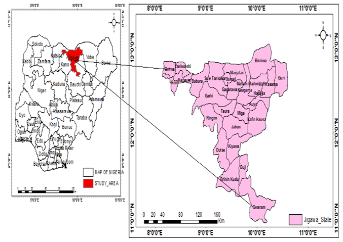
Flooding is one of the natural disasters causing destructions in Jigawa state, Nigeria. Since 2018, flood has been claiming lives and properties across Jigawa. The real figures on loss of lives and properties have not been scientifically reported. The aim of this research is to conduct a geospatial profiling of flood victims and associated loss of lives and properties in the aftermath of 2022 floods in Jigawa. Fatality locations were determined through indexing and buffering using GeoEye, LandSat 8 and Shuttle Radar Topography Mission images. Extent of flooded areas in August, September and October, 2022 were determined using modified normalized difference water index. All analyses were done in ArcGIS 10.3 and SPSS. Out of the 27 Local Government Areas, 19 were affected. Areas with highest flooding were: Guri, Kirikasamma, Miga, Auyo and Ringim in descending order. Most of the flood prone areas were characterized by low elevation, proximity to water bodies and poor land use planning. Miga LGA recorded the highest number of deaths (20) followed by Kirikasamma (14) Birnin Kudu(13) Kafin Hausa(11) Jahun & Ringim (8) Birniwa (7) Auyo (6) Sule Tankarkar (4) Hadejia & Maigatari (3) Kaugama & Malammadori (2) Gagarawa & Taura (1). About 15 of the LGAs had buildings, farmlands and other structures affected. Causes of deaths were attributed to: building collapse (40%) water – borne diseases (20%) drowning in flood waters (15%) motor vehicle accidents (5) canoe – based accidents (5%) snake bites (5%) others (10%). Proper land use planning, resettlement, dredging and river trainings.
References
Abbas, K., Gyasi, R. M., Katey, D., Frempong, F., Garsonu, E. K. (2022). Flood exposure and psychological distress among Ghanaian adults in flood-prone settings. Science of the Total Environment, 835: 155481.
Adger, W. N., Arnell, N. W., Tompkins, E. L. (2005). Successful Adaptation to Climate Change across Scales. Global Environmental Change, 15(2): 77-86.
Alfa, M. I., Ajibike, M. A., Daffi, R. E. (2018). Application of Analytic Hierarchy Process and Geographic Information System Techniques in Flood Risk Assessment: A Case of Ofu River Catchment in Applications of Analytic Hierarchy Process and Geographic Information System Techniques in Flood Risk Assessment. Journal of Degraded and Mining Lands Management, 5(4),1363–1372. https://doi.org/10.15243/jdmlm.
Asif, S., Jianzhong, L., Xiaoling, C., Chikondi, C., Nausheen, M. (2023). Rapid Assessment of Riverine Flood Inundation in Chenab Floodplain Using Remote Sensing Techniques. Geoenviron Disasters 10, 9 (2023). https://doi.org/10.1186/s40677-023-00236-7
Chakraborty, S., & Mukhopadhyay, S. (2019). Assessing Flood Risk Using Analytical Hierarchy Process (AHP) and Geographical Information Systems Application. Natural Hazards, (0123456789). https://doi.org/10.1007/s11069-019-03737-7.
Di Baldassarre, G., Montanari, A., Lins, H., Koutsoyiannis, D., Brandimarte, L., Blöschl, G. (2010). Flood Fatalities in Africa: From diagnosis to Mitigation. Geophysical Research Letters, 37(22).
Dottori, F., Martina, M.L, V., Rui, F. (2016). A Methodology for Flood Susceptibility and Vulnerability Analysis in Complex Flood Scenarios. Journal of Flood Risk Management. February 2016 11(4): n/a-n/a. DOI:10.1111/jfr3.12234
Douglas, I., Alam, K., Maghenda, M., Mcdonnell, Y., McLean, L., Campbell, J. (2008). Unjust Waters: Climate Change, Flooding and the Urban Poor in Africa. Environment and Urbanization, 20(1), 187-205.
Ghosh, R. & Swades, P. (2023). Delineation of Vegetation Shaded Ox-Bow Lakes in Ganges Flood Plain, India. Ecological Informatics.Volume 74, May 2023, 101954
Iliyasu, U. (2017). Flood Risk Assessment in Parts of Hadejia- Jama’ are River Basin (HJRB) of Jigawa State. Unpublished M.Sc. Thesis, Department of Geography, Faculty of Earth and Environmental Sciences, Bayero University, Kano.
Kayode, S.J., Yakubu, S., Ologunorisa, T.E., Kola – Olusonya, A. (2017). A Post-Disaster Assessment of Riverine Communities Impacted by a Severe Flooding Event. Ghana Journal of Geography Vol. 9(1), 2017 pages 17–41
Komi, K., Amisigo, B. A., Diekkrüger, B. (2016). Integrated Flood Risk Assessment of Rural Communities in the Oti River Basin, West Africa. Hydrology, 3(4), 42.
Komolafe, A. A., Adegboyega, S. A., Akinluyi, F. O. (2015). A Review of Flood Risk Analysis in Nigeria. American Journal of EnvironmentalSciences, 11(3), 157–166. https://doi.org/10.3844/ajessp.2015.157.166.
Kundzewicz, Z. W., & Schellnhuber, H. J. (2004). Floods in the IPCC TAR Perspective. Natural Hazards, 31, 111-128.
Kwari, J. W., Paul M. K., Shekarau, L. B. (2015). The Impacts of Flooding on Socio-Economic Development and Agriculture in Northern Nigeria: A Case Study of 2012 Flooding in Yola and Numan Areas of Adamawa State Nigeria. International Journal of Scientific & Engineering Research, Volume 6, Issue 7, July-2015 1433 ISSN 2229-5518.
Li, W., Lin, K., Zhao, T., Lan, T., Chen, X., Du, H., Chen, H. (2019). Risk Assessment And Sensitivity Analysis of Flash Floods in Ungauged Basins Using Coupled Hydrologic and Hydrodynamic Models. Journal of Hydrology, 572 (March), 108–120.
Mc Feeters, S.K. (1996). The Use of Normalized Difference Water Index (NDWI) in the Delineation of Open Water Features. International Journal of Remote Sensing, 17, pp. 1425–1432.
Memon, A., Muhammad, S., Rahman, S., Haq, M. (2015). Flood Monitoring and Damage Assessment Using Water Indices: A Case Study of Pakistan flood-2012. Egypt. J. Remote Sens. Space Sci. 2015, 18, 99–106, doi:10.1016/j.ejrs.2015.03.003
National Bureau for Statistics (2020). Demographic Statistics Bulletin. A Publication of Demographic Statistics Division.
Nkeki, F.N., Henah, J.P., Ojeh, V.N. (2013). Geospatial Techniques for the Assessment and Analysis of Flood Risk along the Niger-Benue Basin in Nigeria. Journal of Geographic Information System Vol.5 No.2 (2013), Article ID: 29778, 13 pages DOI:10.4236/jgis.2013.52013
Olaide, A. M., Jagila, J. , Fagbemiro O. A. , Aliyu I., Nwadike B.K. , Ajonye S. E., Salman, K. S. (2014). Geospatial Assessment of 2012 Flood Disaster in Kogi State, Nigeria. IOSR Journal Of Environmental Science, Toxicology And Food Technology (IOSR-JESTFT) e-ISSN: 2319-2402,p- ISSN: 2319-2399.Volume 8, Issue 2 Ver. IV (Mar-Apr. 2014), PP 74-84 www.iosrjournals.org
Olofin, E.A, Nabegu, A.B., Dambazau, A. M. (eds). (2008). WudilWithin Kano Region: A Geographical Synthesis. Joji Publishers, Kano.
Shuaibu, A., Hounkpe, J., Bossa, Y.A., Kalin, R.M. (2022). Flood Risk Assessment and Mapping in the Hadejia River Basin, Nigeria, Using Hydro-Geomorphic Approach and Multi-Criterion Decision-Making Method. Water 2022, 14(22), 3709; https://doi.org/10.3390/w14223709
Tramblay, Y., Villarini, G., Zhang, W. (2020). Observed Changes in Flood Hazards in Africa. Environmental Research Letters, 15(10), 1040b5.
Vu, T. T., & Ranzi, R. (2016). Flood Risk Assessment and Coping Capacity of Floods in Central Vietnam. Journal of Hydro-Environment Research. https://doi.org/10.1016/j.jher.2016.06.001.
World Health Organization, WHO. (2018). Nigeria Rushes into Current Flash Flooding to Mitigate Health Hazards. WHO Regional Office for Africa. Accessed February 10, 2020, from https://www.afro.who.int/news/nigeria-rushes-current-flash-flooding-mitigate-healthhazards.
Xu, H. (2006). Modification of Normalized Difference Water Index (NDWI) to Enhance Open Water Features in Remotely Sensed Imagery. International Journal of Remote sensing, Vol. 27, No. 14, 20 July 2006, 3025–3033
Downloads
Published
Issue
Section
Categories
License
Copyright (c) 2026 Ibrahim Yakubu Tudunwada, Abbas Ahmad

This work is licensed under a Creative Commons Attribution 4.0 International License.

