
SHORELINE EXTRACTION FROM HIGH-RESOLUTION OPTICAL IMAGERY USING A U-NET-BASED SEMANTIC SEGMENTATION APPROACH
DOI:
https://doi.org/0.33003/fjs-2026-1004-4835Keywords:
Keyword Automated, Google Earth, Semantic segmentation, Binary segmentation, Coastline delineationAbstract
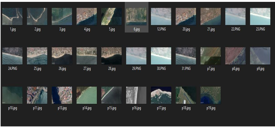
Accurate shoreline delineation is fundamental for coastal monitoring, environmental management, and hazard mitigation. This study presents a deep learning–based semantic segmentation framework for automated shoreline extraction from high-resolution optical imagery using a U-Net architecture. A dataset comprising 31 manually annotated coastal images was augmented through geometric transformations to generate 155 image–mask pairs for model training, validation, and testing. The network was optimized using the Adam optimizer and a hybrid Dice–Binary Cross-Entropy loss function to mitigate class imbalance between land and water pixels. Model performance was evaluated using Accuracy, Precision, Recall, F1-score, and Intersection over Union (IoU) metrics. Validation results demonstrated strong segmentation performance, achieving an Accuracy of 98.63%, Precision of 83.58%, Recall of 81.75%, and F1-score of 81.93%. On an independent test dataset representing diverse coastal environments, the model attained an Accuracy of 98.33% and an F1-score of 78.24%, indicating robust generalization under heterogeneous imaging conditions. Despite the limited dataset size, the results confirm the methodological feasibility and reliability of U-Net-based semantic segmentation for shoreline delineation. The proposed framework offers a reproducible and computationally efficient foundation for scalable shoreline mapping and future multi-temporal coastal monitoring applications.
References
Abujayyab, S. K. M. (2025). Deep learning–based semantic segmentation for surface water extraction from Sentinel-2 imagery: Case study of Kuş and Uluabat lakes, Türkiye. Turkish Journal of Remote Sensing, 7(1), 91–106. https://doi.org/10.51489/tuzal.1647078
Angelini, R., Angelats, E., Luzi, G., Masiero, A., Simarro, G., & Ribas, F. (2024). Development of methods for satellite shoreline detection and monitoring of megacusp undulations. Remote Sensing, 16(23), 4553. https://doi.org/10.3390/rs16234553
Angnuureng, D. B., Charuka, B., Almar, R., Dada, O. A., Asumadu, R., Agboli, N. A., & Ofosu, G. T. (2025). Challenges and lessons learned from global coastal erosion protection strategies. iScience, 28(4), 112055. https://doi.org/10.1016/j.isci.2025.112055
Asensio-Montesinos, F., Molina, R., Anfuso, G., Manno, G., & Lo Re, C. (2024). Natural and human impacts on coastal areas. Journal of Marine Science and Engineering, 12(11), 2017. https://doi.org/10.3390/jmse12112017
Balakrishnan, P., Abulibdeh, A., & Abul Kasem Kabir, T. (2023). Assessment of the impact of anthropogenic evolution and natural processes on shoreline dynamics using multi-temporal satellite images and statistical analysis. Water, 15(8), 1440. https://doi.org/10.3390/w15081440
Belward, A. S., & Skøien, J. O. (2015). Who launched what, when and why: Trends in global land-cover observation capacity from civilian Earth observation satellites. ISPRS Journal of Photogrammetry and Remote Sensing, 103, 115–128. https://doi.org/10.1016/j.isprsjprs.2014.03.009
Christofi, D., Mettas, C., Evagorou, E., Stylianou, N., Eliades, M., Theocharidis, C., Chatzipavlis, A., Hasiotis, T., & Hadjimitsis, D. (2025). A review of open remote sensing data with GIS, AI, and UAV support for shoreline detection and coastal erosion monitoring. Applied Sciences, 15(9), 4771. https://doi.org/10.3390/app15094771
Cosby, A. G., Lebakula, V., Smith, C. N., Wanik, D. W., Bergene, K., Rose, A. N., Swanson, D., & Bloom, D. E. (2024). Accelerating growth of human coastal populations at the global and continent levels: 2000–2018. Scientific Reports, 14, 22489. https://doi.org/10.1038/s41598-024-73287-x
Dang, K. B., Dang, V. B., Ngo, V. L., Vu, K. C., & Nguyen, H. D. (2022). Shoreline extraction using deep learning models from high-resolution remote sensing images. Sensors, 22(15), 5634. https://doi.org/10.3390/s22155634
Donchyts, G., Baart, F., Winsemius, H., Gorelick, N., Kwadijk, J., & van de Giesen, N. (2016). Earth’s surface water change over the past 30 years. Nature Climate Change, 6(9), 810–813. https://doi.org/10.1038/nclimate3111
Google LLC, 2024. Google Earth Pro. https://www.google.com/earth/Accessed 15 August 2024
Kundu, K., Mandal, J.K. Shoreline Change Detection and Future Prediction of Sundarban Delta Using Remote Sensing Data and Digital Shoreline Analysis System. J Indian Soc Remote Sens 52, 485–503 (2024). https://doi.org/10.1007/s12524-024-01833-1
Li, J., Roy, D. P., Zhang, H. K., & Yan, L. (2019). Shoreline change detection using Landsat time series in a cloud computing environment. Remote Sensing of Environment, 232, 111302. https://doi.org/10.1016/j.rse.2019.111302
Liu, Y., Wang, C., Ye, M., & Han, R. (2024). Coastal zone classification based on U-Net and remote sensing. Applied Sciences, 14(16), 7050. https://doi.org/10.3390/app14167050
Mahmoud, A. S., Mohamed, S. A., Helmy, A. K., & Nasr, A. H. (2025). BDCN-UNet: Advanced shoreline extraction techniques integrating deep learning. Earth Science Informatics. https://doi.org/10.1007/s12145-024-01693-w
Maul, G. A., & Duedall, I. W. (2019). Demography of coastal populations. In C. W. Finkl & C. Makowski (Eds.), Encyclopedia of coastal science (pp. xx–xx). Springer. https://doi.org/10.1007/978-3-319-93806-6_115
McAllister, E., Payo, A., Novellino, A., Dolphin, T., & Medina-Lopez, E. (2022). Multispectral satellite imagery and machine learning for the extraction of shoreline indicators. Coastal Engineering, 174, 104102. https://doi.org/10.1016/j.coastaleng.2022.104102
Milletari, F., Navab, N., & Ahmadi, S.-A. (2016). V-Net: Fully convolutional neural networks for volumetric medical image segmentation. In Proceedings of the 2016 Fourth International Conference on 3D Vision (3DV) (pp. 565–571). IEEE. https://doi.org/10.1109/3DV.2016.79
Remote sensing shoreline extraction method based on an optimized DeepLabV3+ model: A case study of Koh Lan Island, Thailand. (2025). Journal of Marine Science and Engineering, 13(4), 665. https://doi.org/10.3390/jmse13040665
Santos, F., Cunha, T. R., & Baptista, P. (2025). Deep learning–based semantic segmentation for automatic shoreline extraction in coastal video monitoring systems. Remote Sensing, 17(23), 3865. https://doi.org/10.3390/rs17233865
Ustin, S. L., & Middleton, E. M. (2024). Current and Near-Term Earth-Observing Environmental Satellites, Their Missions, Characteristics, Instruments, and Applications. Sensors, 24(11), 3488. https://doi.org/10.3390/s24113488
Yang, F., Chen, G., & Duan, J. (2024). Skip-encoder and skip-decoder for detection transformer in optical remote sensing. Remote Sensing, 16(16), 2884. https://doi.org/10.3390/rs16162884
Zhang, Y., Li, H., Li, D., Hou, X., Guo, P., & Guo, J. (2024). Evolutionary dynamics of island shoreline in the context of climate change: Insights from extensive empirical evidence. International Journal of Digital Earth, 17(1). https://doi.org/10.1080/17538947.2024.2329816
Zhou, X., Wang, J., Zheng, F., Wang, H., & Yang, H. (2023). An Overview of Coastline Extraction from Remote Sensing Data. Remote Sensing, 15(19), 4865. https://doi.org/10.3390/rs15194865
Downloads
Published
Issue
Section
Categories
License
Copyright (c) 2026 Godsent Efosa Felix, Destiny Osazee, Uchenna Ukeme, Stephen Olushola Oladosu

This work is licensed under a Creative Commons Attribution 4.0 International License.

