
Spatio-Temporal Dynamics of Fractional Vegetation Cover Change in Zamfara State, Nigeria (1985–2020): A Landsat and CLASlite Approach
DOI:
https://doi.org/10.33003/fjs-2026-1010-5009Keywords:
Remote sensing, Vegetation cover, Change detection, CLASlite, Landsat, Fractional coverAbstract
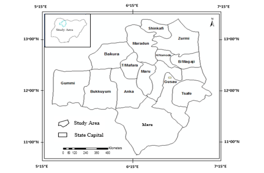
Vegetation degradation remains a critical environmental issue in semi-arid regions of Nigeria, where population growth, agricultural expansion, and climatic variability drive land-cover changes. This paper quantified the spatio-temporal dynamics of vegetation cover across Zamfara State over a 35-year period (1985–2020) using multi-temporal Landsat imagery (TM, ETM+, OLI) processed with the CLASlite algorithm to derive fractional vegetation cover. Eight epochs (1985, 1990, 1995, 2000, 2005, 2010, 2015, and 2020) were analysed using change-vector analysis and accuracy assessment through confusion matrices and Kappa statistics. Results indicate a consistent decline in photosynthetic vegetation cover from 65.3% in 1985 to 34.8% in 2020, with the central and northwestern parts of the state showing the most pronounced losses. The findings highlight accelerating vegetation degradation particularly after 2000, correlating with increased anthropogenic pressures. This long-term assessment provides a valuable baseline for sustainable land-use planning, ecological restoration, and policy development toward combating desertification in semi-arid Nigeria.
References
Asner, G. P., Knapp, D. E., Balaji, A., & Páez-Acosta, G. (2009). Automated mapping of tropical deforestation and forest degradation: CLASlite. Journal of Applied Remote Sensing, 3(1), 033543.
Carvalho Júnior, O. A., Guimarães, R. F., Gillespie, A. R., Silva, N. C., and Gomes, R. A. (2011). A New Approach to Change Vector Analysis using Distance and Similarity Measures. Remote Sensing, 3(11), 2473-2493.
Cooper, S., Okujeni, A., Jänicke, C., Clark, M., van der Linden, S., and Hostert, P. (2020). Disentangling fractional vegetation cover: Regression-based unmixing of simulated spaceborne imaging spectroscopy data. Remote Sensing of Environment, 246, 111856.
Daniel, A.M, and Ayobami, T.S, (2007). ‘Application of Remote Sensing and GIS in Land use/Land Cover Mapping and Change Detection in parts of South Western Nigeria' African Journal of Environmental science and technology 1 (5), PP 99 – 107
De Jong, R., de Bruin, S., de Wit, A., Schaepman, M. E., and Dent, D. L. (2011). Analysis of monotonic greening and browning trends from global NDVI time-series. Remote Sensing of Environment, 115(2), 692-702.
Deng, Z., Zhu, X., He, Q., and Tang, L. (2019). Land use/land cover classification using time series Landsat 8 images in a heavily urbanized area. Advances in Space Research 63 (7), 2144–2154. https://doi.org/10.1016/j.asr.2018.12.005.
Fragou, S., Kalogeropoulos, K., Stathopoulos, N., Louka, P., Srivastava, P. K., Karpouzas, S. P. and Petropoulos, G. (2020). Quantifying land cover changes in a mediterranean environment using Landsat TM and Support Vector Machines. Forests, 11(7), 750.
Thapa, R., Bahuguna, V., Negi, P., Rana, P. S., Kataria, P., Rawat, G., ... & Sharma, T. (2023). Examining the spatio-temporal relationship between LST, NDVI, NDBI and LULC change of Pachhua dun, Dehradun, Uttarakhand (India). JGISE: Journal of Geospatial Information Science and Engineering, 6(2), 136-152.
Tucker, C. J., Vanpraet, C., Boerwinkel, E., and Gaston, E. A. (2023). Satellite remote sensing of total dry matter production in the Senegalese Sahel. Remote Sensing of Environment, 13(6), 461-474.
Downloads
Published
Issue
Section
Categories
License
Copyright (c) 2026 Muhammad Nura Mustapha

This work is licensed under a Creative Commons Attribution 4.0 International License.